Background
River and lake ecological flow is the basis for maintaining the structure and function of ecosystems. And the quality and stability of the ecological system of rivers and lakes are improved by enhancing their ecological flow. In recent years, various disturbances such as social water cycle pumping, sewage discharge, dam construction, embankment repair, and reclamation have exceeded the self-regulation and tolerance capacity of natural water circulation, leading to the shrinking of rivers and lakes and the degradation of the ecological environment. Therefore, based on the principles of water conservation priority, spatial balance, systematic governance, and dual-handed efforts, and combined with many years of experience in the water industry, Bivocom has independently developed monitoring solution for rivers and lakes to optimize water resources, strictly manage river and lake ecological flow, and ensure ecological safety in the basin.
Overview of the Solution
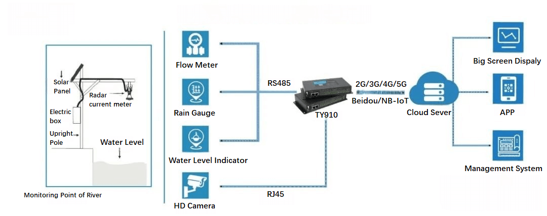
Bivocom’s monitoring solution for rivers and lakes mainly aims to achieve automated monitoring and intelligent warning. Based on cutting-edge technologies such as the Internet of Things, wireless communication, big data, cloud computing, and edge computing, it can comprehensively monitor the entire key area of the river and lake, achieve automatic collection of river and lake data, data storage, and automatic transmission functions. And using the Bivocom IoT cloud platform to automatically receive and store river and lake monitoring information, fully leveraging the information interconnection between the monitoring center and the front-end sensing to provide data support for management personnel’s command and dispatch.
Plan Principles
-
Sensing Layer
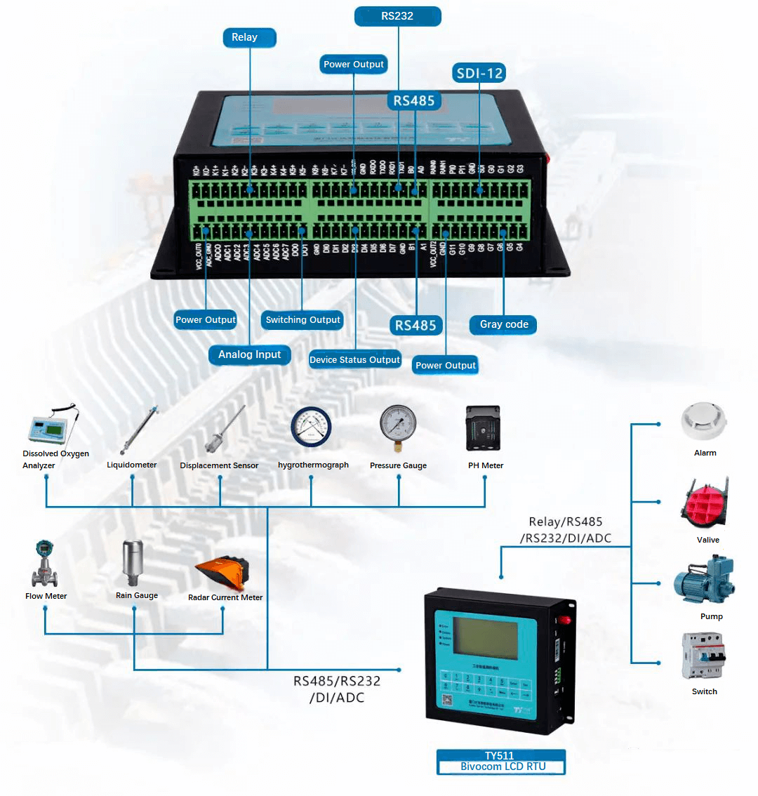
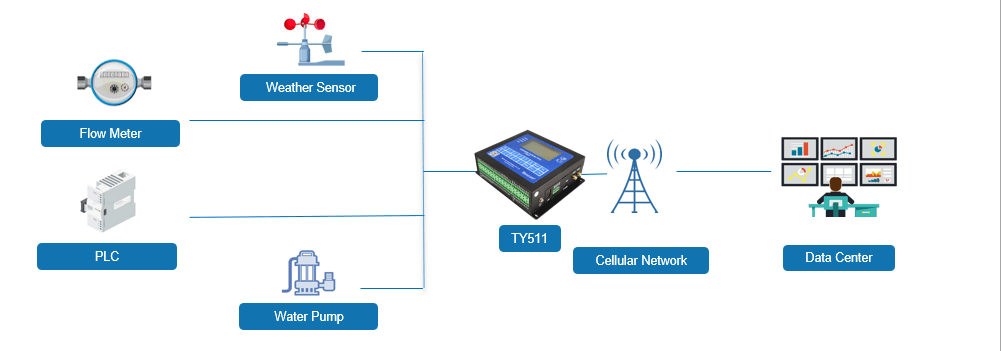
The main core component is the Bivocom LCD RTU TY511, which is connected to sensing devices such as current meters, HD cameras, power supplies, rain gauges, etc., to monitor in real-time all elements of the rivers and lakes, including water level, flow velocity, flow, water quality, salinity, water depth, etc.
-
Network Layer
Using the 5G network as the main network and the Beidou satellite network as the auxiliary network, while supporting communication methods such as WAN, LAN, and WiFi to achieve data transmission and sharing between the monitoring area and the monitoring center.
-
Platform Layer
With the help of the Bivocom LCD RTU TY511, data transmission, storage, processing, and analysis are carried out. At the same time, the relevant information of rivers and lakes such as the Bivocom LCD RTU TY511, front-end sensing devices, and detection instruments are highly integrated. Reports are generated based on the monitored data, and corresponding execution commands are issued to the front-end sensing devices through signal connection.
-
Application Layer
Bivocom monitoring center sends real-time reports to multiple management centers that can transmit data simultaneously. Management personnel at all levels can query and analyze the data of river and lake ecological flows according to their permissions.
Solution Functions
-
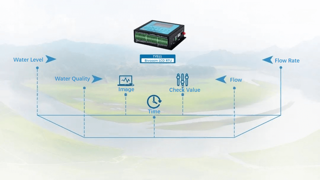
Real-time Monitoring
Real-time monitoring of water level, water quality, flow rate, river and lake ecological flow values, monitoring images, monitoring time, and confirmed values of river and lake ecological flow.
-
Intelligent Warning
When parameters such as water level and flow rate are too low to meet the minimum requirements or when video monitoring is offline, and station data is missing, timely warning can be issued through the monitoring platform, achieving real-time supervision.
-
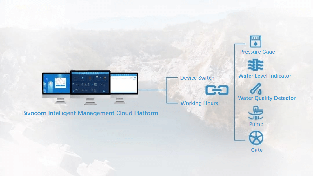
Remote Management
Users can remotely control and manage river and lake ecological flows in the monitoring center, including setting equipment switches and working time via remote commands.
-
GIS Map Display
This function can display the distribution of various river and lake ecological flow monitoring points and ecological flow data in real-time. Management personnel can filter the geographic locations of various river and lake monitoring points to view the distribution of ecological flows in designated areas of hydropower stations.

Comment